As a coastal city, Zamboanga is surrounded by the sea on three sides. It is bordered by the Moro Gulf to the east, the Basilan Strait to the south, and the Sulu Sea to the west. The city’s only land borders lie to the north, where it meets the provinces of Zamboanga del Norte and Zamboanga Sibugay. It’s no surprise that more than half of the city’s 98 barangays are classified as coastal barangays.
The Coastal Barangays of Zamboanga City
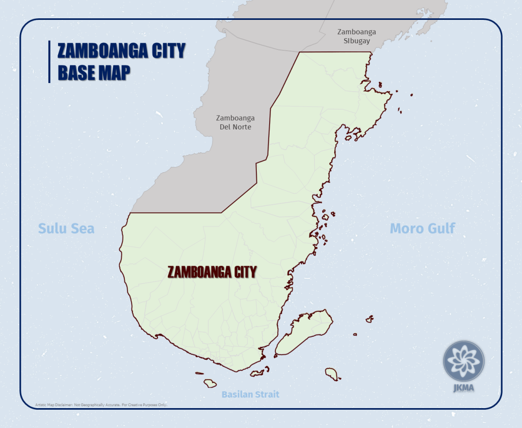
According to the city government of Zamboanga, there are 54 areas classified as coastal barangays. However, pinpointing which barangays are included can be challenging, particularly regarding the last three. It turns out they included Taguiti, Tagasilay, and Vitali in the list.
Taguiti and Tagasilay are classified as coastal barangays primarily because a small segment of their territorial boundaries touches the coast. However, this coastal access is limited to just a single point for each barangay. This means that while they are officially recognized as coastal areas, the extent of their coastline is confined to these specific points where their boundaries intersect with neighboring barangays.

Interestingly, Vitali is also included. On the map, Vitali appears to be landlocked, but this is not the case. The areas known as Limaong and Tumitus, which are coastal barangays before reaching Vitali, actually form an island. This means that Barangay Vitali is not blocked by other coastal barangays but is indeed coastal due to this island. In fact, Vitali Island where Limaong and Tumitus are located is the largest island in the city, surpassing even Sacol Island. Thus, Barangay Vitali is classified as a coastal barangay.
Please respect our hard work by not copying and pasting this entire article into your own posts. As a small blog, JKMA has often been a victim of bloggers who simply grab and repost our stories as their own. We kindly ask that you use the share button on our official social media once the article is posted. Researching, writing, and editing are not easy tasks, so please support us by sharing our content properly and giving credit where it’s due. Your cooperation helps us continue providing quality content for our readers. Thank you for understanding and support.
JKMA
Coastal barangays refer to areas located along the coastline of a city or region, directly adjacent to bodies of water such as seas, oceans, or gulfs. These areas are characterized by their proximity to the coast, which influences their economic activities, cultural practices, and environmental conditions.
The significance of coastal barangays lies in their strategic access to maritime resources and opportunities. They often serve as hubs for fishing industries, maritime trade routes, and tourism, contributing significantly to local economies. The city of Zamboanga, for instance, boasts a total coastline length of 301 kilometers, offering scenic beaches, diverse marine life, and water-based recreational activities that attract tourists from around the world.
Credits to City Government of Zamboanag
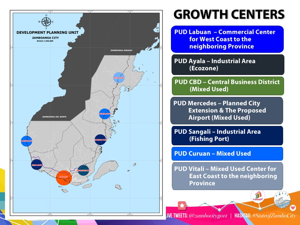
Additionally, coastal areas are generally more conducive to settlement and urban development compared to landlocked regions. The availability of natural harbors and coastal plains provides ample space for residential and commercial expansion, supporting population growth and infrastructure development. Given that the city’s rural areas are still undeveloped, and the southern areas are already urbanized or compact, Zamboanga City has significant potential for expansion. With a substantial coastline length, which totals 301 kilometers, there is ample opportunity to develop ports and other critical infrastructure along the coast.
Please respect our hard work by not copying and pasting this entire article into your own posts. As a small blog, JKMA has often been a victim of bloggers who simply grab and repost our stories as their own. We kindly ask that you use the share button on our official social media once the article is posted. Researching, writing, and editing are not easy tasks, so please support us by sharing our content properly and giving credit where it’s due. Your cooperation helps us continue providing quality content for our readers. Thank you for understanding and support.
JKMA
Zamboanga City is renowned as the sardines capital of the Philippines, with numerous factories located predominantly in coastal barangays such as Ayala and Recodo. The presence of these industries underscores the economic importance of coastal areas, where fishing and seafood processing thrive due to proximity to marine resources.

Moreover, the Zamboanga Ecozone boasts its own port infrastructure, strategically located away from the congested city proper. This port plays a crucial role in facilitating trade and commerce, contributing to regional economic growth and employment opportunities.
The east coast, including barangays like Sangali, also offers thriving port infrastructure that supports local industries and facilitates regional connectivity. Looking forward, efforts are underway to develop additional port infrastructure in northern barangays, which will further enhance the city’s capacity for maritime trade and economic development.
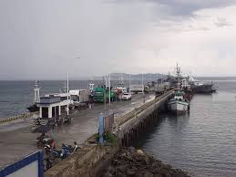
Credits to Philippine Fisheries Development Authority-Zamboanga Fish Port Complex
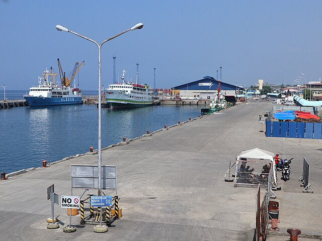
Credits to Wikipedia
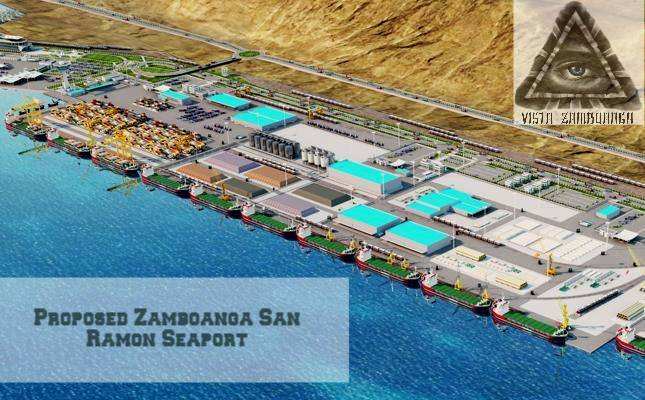
Credits to Vista Zamboanga
Zamboanga City’s coastal barangays not only offer prime opportunities for economic activities such as fishing, seafood processing, and maritime trade but also provide essential space for sustainable urban and industrial growth. By leveraging its extensive coastline and investing in strategic infrastructure projects, Zamboanga City can continue to foster economic resilience and enhance its role as a vital economic hub in the region.

Other Post:
